Finding a picture…
Not listedEstimate $1.40m – $2.17m
4
4811B State Highway 29, Matamata
State Highway 29 in Matamata has 39 properties, valued by the council between $410,000 and $1,700,000 with a median of $700,000 (Matamata: $710,000). More of its homes were built in the 1950s than in any other decade. We estimate its homes at a median $710,500. 1 sold in the last twelve months.
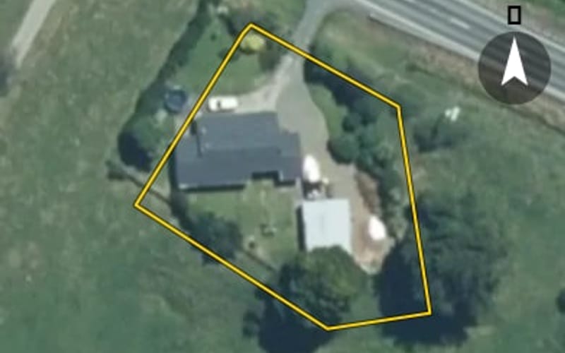 AerialNot listed
The council values State Highway 29's 26 rated properties between $410,000 and $1,700,000. The middle half sit between about $510,000 and $848,750; the median is $700,000 and the mean $748,269.
| Bedrooms | Homes | Median council value | Sold, last 12 months | Median sale |
|---|---|---|---|---|
| 1 | 1 | $825k | 0 | — |
| 2 | 1 | $410k | 0 | — |
| 3 | 18 | $595k | 0 | — |
| 4 | 4 | $1.17m | 0 | — |
| 5+ | 2 | $1.16m | 1 | — |
Council rating valuations: the council's figure for apportioning rates, not a market appraisal.
State Highway 29's median council value is about the same as Matamata's.
| State Highway 29 | Matamata | Matamata | |
|---|---|---|---|
| Median council value | $700k | $710k | $710k |
| Sold in the last 12 months | 2.6% | 3.8% | 3.6% |
| Median section | 2,474 m² | 812 m² | 832 m² |
| Median year built | 1950 | 1980 | 1980 |
| Council value per m² of floor | $5k | $5k | $5k |
Median sale price by year; 2025 is the year so far. A year with fewer than two sales has no bar.
| Year | Sales | Median price | Per m² floor |
|---|---|---|---|
| 2025 | 2 | $930,000 | $4,612 |
| 2024 | 1 | $560,000 | $6,364 |
| 2021 | 1 | $1,145,500 | $4,135 |
| 2020 | 2 | $652,500 | $2,762 |
| 2019 | 1 | $465,000 | $3,444 |
| 2018 | 1 | $465,000 | $3,690 |
| 2017 | 2 | $316,000 | $2,209 |
| 2016 | 2 | $336,500 | $1,807 |
State Highway 29 has 38 houses. More were built in the 1950s than in any other decade (35%).
Every street in Matamata, and the suburb's house prices and sales.
Sales and valuations as at 11 September 2026, from council and LINZ records. Medians resting on fewer than 3 sales are not shown.