Finding a picture…
Not listedEstimate $412k – $548k
1/55 Tahetoka Street, Westgate
Westgate, Auckland · Auckland
Last sold Oct 2023
We estimate it would sell for $596,000 as at 5 October 2026, in a range of $535,000 to $678,000.
| Council valuation, May 2024 | $650,000 |
|---|---|
| Market movement in Auckland since the council valuation | −4.8% |
| Apartments and houses in Auckland | +0.1% |
| How Westgate sells against council values | −1.6% |
| Homes in this price range | +0.5% |
| Land as a share of the value | −0.6% |
| Nearby recent sales (15) | −1.6% |
| Its own sale in 2020 | −0.4% |
| Our estimate | $596,000 |
We start from the council's rating valuation, move it by how sales in the area have moved since against their own council values, then by how properties like this one, nearby sales and its own last sale have done against the same arithmetic. Each step is an average of real sales. Tested every month against sales we had not seen: half land within about 6% of our estimate, and about 8 in 10 within the range. This is an automated estimate, not a registered valuation.
Sign in to keep private notes on this property and record what you think it is worth.
Estimates from the floor area and typical New Zealand prices, not quotes. Power, gas and internet details from the Electricity Authority and Gas Industry Co registries and Chorus.
 CCB · special
 Kookmin
The lowest rather than the highest is $115 less a fortnight — about $2,987 over the 1 year.
China Construction Bank4.49%s$1,111/fn ICBC4.65%s$1,132/fn
 Bank of China4.68%s$1,136/fn
 AIA New Zealand4.99%$1,177/fn
 ANZ Bank New Zealand4.99%s$1,177/fn
 ASB Bank4.99%$1,177/fn
 Bank of Baroda4.99%$1,177/fn
 Police Credit Union4.99%$1,177/fn
 Unity Credit Union4.99%s$1,177/fn
 Kiwibank5.15%s$1,199/fn
 Bank of New Zealand5.19%$1,204/fn
 SBS Bank5.19%s$1,204/fn
 The Co-operative Bank5.19%s$1,204/fn
 TSB Bank5.19%s$1,204/fn
 Westpac New Zealand5.19%s$1,204/fn
 First Credit Union5.29%s$1,218/fnKookmin Bank Auckland Branch5.35%$1,226/fn
Principal and interest at the lowest advertised card rate, held for the whole loan — no New Zealand rate is. A guide, not a lending offer or financial advice.
From the council’s rating records and the other sources noted on hover. Bedrooms and bathrooms may come from a past listing. Built is the decade the valuer records.
Owners and the parties to each instrument are not published on this page. Order the record of title to see them.
Selling this property, or the agent for it? Import the listing from your agency's site or a portal and it appears here, free: photos, price, open homes and your details, beside the council record buyers are already reading.
Building work the council has consented on this property, newest first. 1 consent on record.
Amendment to bco10354070 - rbw - installation of (4nos.) dormers instead of skylights in bedrooms.
What the council has been asked to allow under the Resource Management Act. 3 on this property · 5 land use or subdivision consents within 250 m.
Our client proposes to construct a two-storey dwelling with a floor area of 234.96m2. This is a permitted activity as per Table H5.4.1. The proposal will require a building consent H5.6.9. Maximum impervious area. H5.6.8. Yards E10 Stormwater management area
Cancel condition 15 as it relates to the staging of the subdivision.
REJECTED - The site is under construction - Rejected s127 lodged as BUN60067476-A - s88 - rejected
The construction and use of a residential dwelling within the Residential – Mixed Housing Urban Zone that results in non-compliances with the height in relation to boundary and outlook standards and the construction and use of a non-compliant vehicle crossing.
The proposal seeks to revise the dwelling typology on the subject site, identified as Lot 197. The boundaries of Lot 197 will remain as per the approved scheme plan.
Condition 1 Two adjacent properties, which have been purchased by the same owner, who seeks to amend the consented architectural concept plans for the respective allotments. refer to our application letter for further details
Ministry for the Environment, National Monitoring System, July 2014 to June 2025. All resource consents
If it is yours, claiming it puts the council record, the title and what it costs you to hold in one place — and lets you put your lending, insurance and power out to people who compete for them.
We check your name against the registered owner on the title before a claim is accepted. Nothing on this page changes for anyone else, and no provider is contacted until you ask.
What the council's published maps say about this land. A map is a model of a storm, not a record of one: a LIM or a flood report says more.
A mapped flood area comes close to this property, but not onto it.
District plan zones as Auckland publishes them. What a site may be used for, and what may be built on it.
Land the council models as under water in a 1-in-100-year storm, usually with an allowance for climate change.
A low point where stormwater ponds if its outlet blocks or overflows.
Land beside a flood plain that could flood if the model is out, or the storm is bigger.
Land the sea reaches in a 1-in-100-year storm tide once sea level has risen by 1 m.
Streets whose built character is protected: demolition and new building are assessed against the area's existing form, whatever the zone allows.
A scheduled historic place. Work on it, including demolition, needs consent against the heritage schedule.
An explicit building height for this land, replacing the one its zone would give.
A protected view of a volcanic cone. Inside it, building height is capped at a fixed level above sea level to keep the cone visible.
A locally protected view of a cone, with its own height ceiling.
The protected view of the Auckland War Memorial Museum.
Skyline land where building height is controlled so the ridge stays a ridge.
A scheduled tree. It may not be felled or topped without consent, which makes it a permanent part of the skyline.
A scheduled stand of trees, protected as a group.
Local rules written for this area alone, which override the underlying zone where they differ.
Source: Auckland Council (CC BY 4.0)
Councils keep registers of land used for activities on the Hazardous Activities and Industries List (HAIL) — service stations, timber treatment, orchards, landfills. A listing records how land was used, not that it is contaminated: most sites have never been tested.
Auckland Council does not publish its contaminated sites records. A site contamination enquiry (a fee applies) or the LIM will say what it holds.
Ask Auckland CouncilSee how big a house this section takes at one, two and three storeys, inside the zone’s yards and height rules. Then ask builders to price the shape you pick.
Counts describe the records we hold for this territorial authority, not a market forecast. Our estimate above is automated, not a registered valuation; how it was reached is shown with it. Every council figure on this page can be checked against the council's own record.
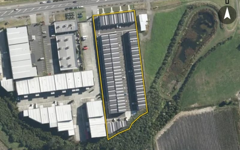 AerialNot listedAerialNot listedAerialNot listedAerialNot listed
People whose office is within 5 km of Westgate, nearest first. Taken from the REA public register -- not ranked by sales, and nobody pays to appear here.

The OwnBetter estimate is our own, from sales and council valuations, and is not a registered valuation.
A single search across NZ property records finds other titles in your name and in companies you are a director of. Most owners find at least one they had forgotten was held somewhere else.