Finding a picture…
Not listed$590,000 CV
3
20 Dillons Point Road, Islington
Islington, Blenheim · Marlborough District
The council's capital value of 80 Dillons Point Road is $650,000 as at 1 Jul 2023: land $370,000 and improvements $280,000.
From the council’s rating records and the other sources noted on hover. Bedrooms and bathrooms may come from a past listing. Built is the decade the valuer records.
Owners and the parties to each instrument are not published on this page. Order the record of title to see them.
Selling this property, or the agent for it? Import the listing from your agency's site or a portal and it appears here, free: photos, price, open homes and your details, beside the council record buyers are already reading.
We hold no building consents for this property yet. The council may hold records we have not seen.
What the council has been asked to allow under the Resource Management Act. None on this property · 14 land use or subdivision consents within 250 m.
To change condition 3 of consent notice 12169431.2 as it affects Lot 4 DP 415671 (RT 560389).
To establish a dwelling with non-compliances relating to recession planes, site coverage, outdoor amenity area and setback from boundaries on Lot 4 DP 415671.
To authorise the existing dwelling on Lot 1 to breach the recession plane associated with the new access leg boundary of Lot 2 (of the lots to be created on the subdivision)
To relocate a dwelling that breaches the recession plane on the eastern boundary of proposed Lot 3 of subdivision consent U200590 and to exceed the fence height standard on current Lot 5 DP 5589.
To build a garage that does not comply with applicablesetback requirementsand to create an additional vehicle crossingonLot2 DP 1582.
Ministry for the Environment, National Monitoring System, July 2014 to June 2025. All resource consents
If it is yours, claiming it puts the council record, the title and what it costs you to hold in one place — and lets you put your lending, insurance and power out to people who compete for them.
We check your name against the registered owner on the title before a claim is accepted. Nothing on this page changes for anyone else, and no provider is contacted until you ask.
What the council's published maps say about this land. A map is a model of a storm, not a record of one: a LIM or a flood report says more.
We do not hold flood maps for Marlborough District yet.
Councils keep registers of land used for activities on the Hazardous Activities and Industries List (HAIL) — service stations, timber treatment, orchards, landfills. A listing records how land was used, not that it is contaminated: most sites have never been tested.
Marlborough District Council does not publish its register. Its property file and the LIM hold HAIL records; ask its HAIL enquiry team.
Counts describe the records we hold for this territorial authority, not a market forecast. OwnBetter has no estimate for this property. Every council figure on this page can be checked against the council's own record.
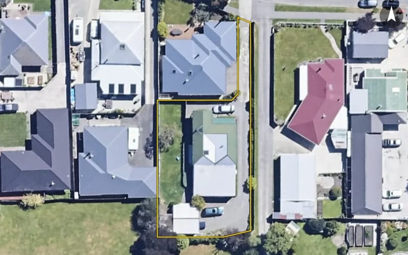 AerialNot listed
People whose office is within 5 km of Islington, nearest first. Taken from the REA public register -- not ranked by sales, and nobody pays to appear here.

A single search across NZ property records finds other titles in your name and in companies you are a director of. Most owners find at least one they had forgotten was held somewhere else.