In a historic area
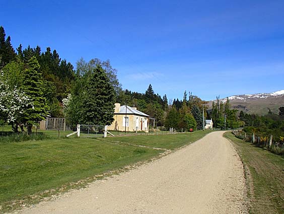
Tom Morgan's Residence (Former)
101 Cambrian Road, Cambrians
101 Cambrian Road: values, sales and more →
Photo: Heather Bauchop, 2012, © Heritage New Zealand Pouhere Taonga
65, 75, 101, 107, 119, 127, 133, 149 and 166 Cambrian Road, Cambrians · Central Otago District
Cambrians Historic Area is a historic area on the New Zealand Heritage List / Rārangi Kōrero, entered on 30 April 2015. The area includes 9 listed places.
Other 1861 · Other 1862 · Other 1918 · Relocation 1954 · Relocation 2006
101 Cambrian Road, Cambrians
101 Cambrian Road: values, sales and more →
Photo: Heather Bauchop, 2012, © Heritage New Zealand Pouhere Taonga
119 Cambrian Road, Cambrians
119 Cambrian Road: values, sales and more →
Photo: Heather Bauchop, 2012, © Heritage New Zealand Pouhere Taonga
127 Cambrian Road, Cambrians
127 Cambrian Road: values, sales and more →
Photo: Heather Bauchop, 2012, © Heritage New Zealand Pouhere Taonga
133 Cambrian Road, Cambrians
133 Cambrian Road: values, sales and more →
Photo: Heather Bauchop, 2012, © Heritage New Zealand Pouhere Taonga
149 Cambrian Road, Cambrians
135 Cambrian Road: values, sales and more →
Photo: Heather Bauchop, 2012, © Heritage New Zealand Pouhere Taonga
149 Cambrian Road, Cambrians
149 Cambrian Road: values, sales and more →
Photo: Heather Bauchop, 2012, © Heritage New Zealand Pouhere Taonga
1 Cambrian Road, Cambrians
166 Cambrian Road: values, sales and more →
Photo: Heather Bauchop, 2012, © Heritage New Zealand Pouhere Taonga
65 Cambrian Road, Cambrians
65 Cambrian Road: values, sales and more →
Photo: Heather Bauchop, 2012, © Heritage New Zealand Pouhere Taonga
75 Cambrian Road, Cambrians
75 Cambrian Road: values, sales and more →
Photo: Heather Bauchop, 2012, © Heritage New Zealand Pouhere Taonga